Geography of Nepal (Topic 1)
Location
- Latitude: 26°22′ N — 30°27′ N
- Longitude: 80°4′ E — 88°12′ E
Constitutional References
- Nation: Dhara 4 of Constitution
- Capital: Kathmandu (Dhara 288)
Area & Dimensions
- Area: 147,181 sq km (56,827 sq miles)
- Length: 885 km
- Breadth: 145 km (min) · 193 km (avg) · 241 km (max)
Share by Area
- SAARC: 2.82% — 4th largest
- Asia: 0.3% — 28th largest
- World: 0.03% — 93rd largest
New Map of Nepal (Chuche / Pointed Map)
- Proposed area by Naapi Bibhag: 148,006 sq km
- Added: Limpiyadhura, Lipulekh, Kalapani
- Ministry: 2077-02-05
- Publicly declared: 2077-02-07
- House of Legislature approved: 2077-02-31
- Rajpatra published: 2077-03-04
Borders
Internal — Extreme Points
- East: Lelep, Taplejung
- West: Limpiyadhura
- North: Humla, Changla Pass
- South: Lodhabari, Jhapa
External — Border Length
- India: 1,690 km
- China: 1,236 km
- Total: 2,926 km
- Nearest sea: Bay of Bengal — 1,127 km
- 3rd nearest country: Bangladesh — 27 km
- 4th nearest country: Bhutan — 32 km
SAARC Capitals — Distance from Kathmandu
| Country | Capital City | Distance (km) |
|---|---|---|
| Bhutan | Thimphu | 402 |
| Bangladesh | Dhaka | 661 |
| India | New Delhi | 816 |
| Pakistan | Islamabad | 1402 |
| Afghanistan | Kabul | 1719 |
| Sri Lanka | Sri Jayawardenepura Kotte / Colombo | 2110 |
| Maldives | Malé | 2760 |
Provinces & Borders
- India-bordering states: Sikkim, West Bengal, Bihar, UP, Uttarakhand
- China-bordering region: Tibet
- Only India: Provinces 2, 5
- Both India & China: Provinces 1, 3, 4, 7
- Only China: Province 6
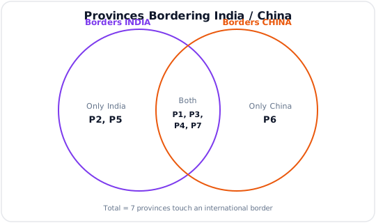
India-only = P2, P5 · Both = P1, P3, P4, P7 · China-only = P6 · Total = 7
Districts & Borders
- Both India & China (IC): 2 — Darchula, Taplejung (DaTa)
- Only India: 25
- Only China: 13
- Neither (IC≠): 37
- Not India (I≠): 50
- Not China (C≠): 62
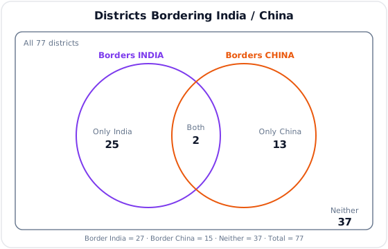
India-only = 25 · Both = 2 · China-only = 13 · Neither = 37 · Total = 77
Time
- Nepal Standard Time set: 2042-01-01 BS
- Reference meridian: Gaurishankar, Dolakha — 86°15′ E
- Elevation: 7,134 m
- Zone: GMT +5:45